| Contact |
Marcos Luna
|
|---|
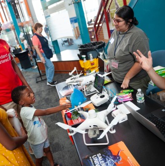
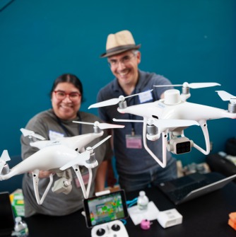
Salem State University Professor Marcos Luna (geography and sustainability department) and master’s student Jeannette Miranda (geo-information sciences) hosted a demonstration of drone technology (i.e., Unmanned Aerial Vehicles) as part of Latino Conservation Week, July 15-23 2023, at the Connecticut Science Center in Hartford, Connecticut. The event was sponsored by the University of Connecticut Extension's Urban and Community Forestry Program with the aim of reaching audiences that are typically excluded from conventional outreach in an intentional matter (e.g., holding events at urban centers, 100% bilingual events, etc.).
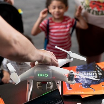
During the day-long event, Miranda and Luna spoke with regular visitors to the Science Center as well as dozens of Latinx families who brought their middle-school and younger children to the event to learn more about the value and interest of education and careers in conservation and environmental science. The Salem State duo showed off the various drones that the geography and sustainability department uses for teaching and research. Visitors were particularly intrigued by the drone's ability to use infrared camera to "see" things that are invisible to the human eye. Children were invited to handle the drone controls (but not fly them!) as well as to experiment with how different materials looked to the infrared camera, including leaves, clothing, their faces, and a blue stuffed toy.
The geography and sustainability department seeks out opportunities for community engagement and public scholarship to share expertise and training both locally and further and afield. Indeed, Jeannette Miranda led a participatory mapping and drone workshop for conservation and indigenous groups in Guatemala in November 2022. Other graduate students and faculty have led similar workshops for communities in Honduras and Ghana. Faculty and students regularly use drones and GIS to work with local conservation organizations on the North Shore as well.
Drones are an essential and expanding domain of geospatial technology that are being applied in a wide variety of applications, including monitoring the health of forests and agricultural lands, urban planning, archaeology, climate science, and disaster response. Salem State University's geography and sustainability department offers formal training in the use and various applications of drone technology through its bachelor of science in cartography and GIS, as well as its master of science and graduate certificate in geo-information science.