| Contact |
Stephen Young
|
|---|
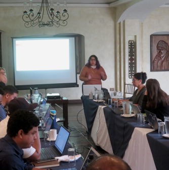
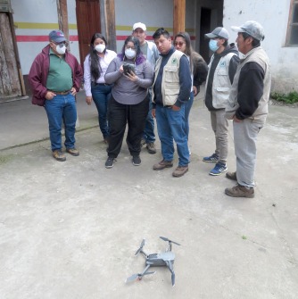
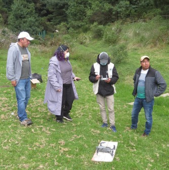
Salem State University Professor Stephen Young (Geography and Sustainability Department) and master’s student Jeannette Miranda (Geo-Information Sciences) traveled to Guatemala for a week (November 7-14) to run a “Participatory Mapping” workshop for 15 conservation organizations from Mexico, Belize, Guatemala, Honduras, and Nicaragua. After the three-day workshop they traveled to the mountainous Mayan indigenous region of Totonicapan, Guatemala to teach organizations from Mexico, Honduras, and Guatemala how to use drones for forest monitoring and for Jeannette to collect data for her master’s thesis.
Each of the 15 organizations sent their technical minded people to the workshop to learn the latest geo-spatial software for mapping, how to use GPS units to collect data points, and how to use drones to image the land from above. Each of the groups are involved in widely different undertakings, but geo-spatial data are critical to all of their activities. For example, members of the Sarteneja Alliance for Conservation and Development work with the Mayan indigenous community in southern Belize for sustainable forestry and property rights. They have trained local women to use GPS units to collect the boundaries of their land, which they put into a Geographic Information System (GIS), create maps, and then petition the government for their land rights. These geo-referenced maps provide evidence for their claims and the training of women raises their status in the community. Another group, the Mesoamerican Development Institute works with coffee farmers in Honduran, to help the farmers earn more income from planting and nurturing natural forests from degraded land around their coffee plantations. This organization is creating a path for carbon offsets to be paid to the farmers to plant trees, taking carbon out of the atmosphere and bringing back the natural forest. Early next year professor Young and another Salem State graduate student will travel to Honduras to help create a drone plan to map degraded forests.
Jeannette Maranda is a first generation El Salvadoran American, first-generation college student and now an outstanding geo-spatial expert. Jeannette was enthused to go to Central America to share the geo-spatial knowledge she learned at Salem State University. She taught most of the workshop in Spanish. Before coming to Salem State University, Jeannette struggled with school and didn’t know what to do in the future. She came from Northshore Community College to the Geography and Sustainability department through a specific transfer program. It wasn’t until studying at Salem State that she found her intellectual and technical capabilities which were then used in Guatemala. Jeannette is a role model showing what can happen when a student finds their passion at Salem State University. This project was funded by the New England Biolabs Foundation and our participation was possible because of the support given to professor Young and Ms. Miranda from the School of Graduate Studies through a Research Assistantship. In 2018 professor Young ran a similar workshop with graduate students in Ghana.